By
Danilo Urzedo
/
Noel Chung
Fire
MapBiomas Fire presents the impacts of fire in Brazil over 36 years. In each of these years, Brazil burned an area larger than England - 150,957 sq kilometres per year.
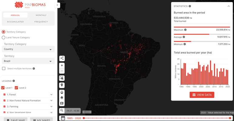
Screenshot of MapBiomas fire platform. Image source: MapBiomas [screenshot]. Retrieved 8 April, 2022 from https://mapbiomas.org/