Identifying Restoration Opportunities
Technologists and scientists adopted biophysical data combined with population density datasets to map current and possible forest distribution on earth. As result, this Atlas identified 2 billion hectares of land as potential sites for forest restoration. While this assessment demonstrated the feasibility of establishing large-scale restoration targets as part of international agreements, there are several concerns with using a technical approach and aerial views of landscapes to indicate how to prioritize degraded areas to be restored.
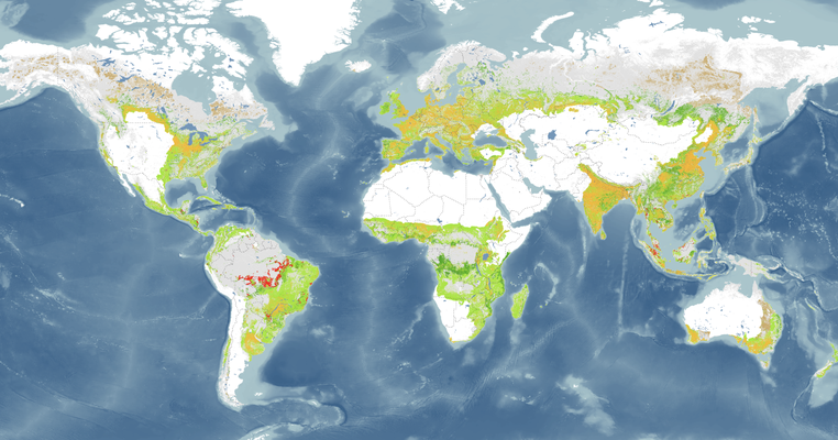
For instance, how are 'degraded' or 'deforested' lands being defined? Scientists working on grassland and savannah ecologies have raised concerns that the Atlas identifies large areas of longstanding grassland or open-canopy woodland as degraded or deforested land rather as than complex biodiverse environments. For example, Veldman et al. (2015) and Bond (2016) argue that the afforestation of some of these grasslands through tree planting, fire suppression, and the exclusion of grazing animals could have negative impacts in terms of biodiversity and longstanding carbon sequestration.